Manchester Airport (MAN)
City Orientation and Maps
(Manchester, England)
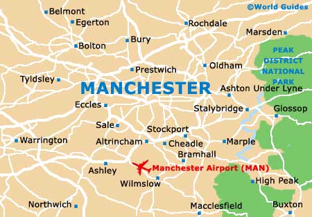
The city of Manchester lies in the county of Lancashire, in northern England. Manchester is located close to a number of important cities and towns, such as Bolton and Rochdale to the north, Pemberton to the west, Sheffield to the south-east, and Macclesfield directly south, close to Manchester International Airport (MAN).
Further afield, Manchester is located to the south-west of Leeds, which can be reached in less than one hour by car, being situated around 80 km / 50 miles away. Also worth noting, the city of Liverpool is situated just 55 km / 34 miles west of Manchester, with a journey time of 40 minutes by car.
Manchester International Airport (MAN) Maps: Important City Districts
The city centre is simple to get around on either foot or by using the reliable Metrolink tramway. Comprising a number of notable districts, the city of Manchester is full of character. Located in the very heart of the action, Manchester's Piccadilly Gardens is a public square around which a range of attractions reside, including the bohemian Northern Quarter to the north, and both Canal Street and the Gay Village to the south-east.
Nearby you fill find the Chinatown district, where a couple of busy and colourful streets are lined with authentic Asian restaurants. Close to Manchester's historic cathedral is the attractive Millennium Quarter, which has recently been redeveloped. Other areas of interest include the Deansgate Locks and Castlefield to the south-west, and the University of Manchester to the south, along Oxford Street.
England Map

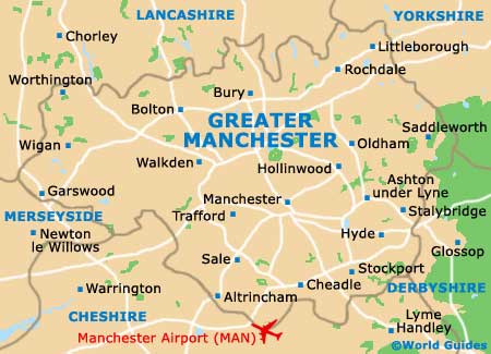
Greater Manchester Map
Manchester Map